
 |
This is image report number three of five covering a three day period of storms over N. Ireland. Sunday June 14th 2009 produced three thunderstorms, the first two where located over Maghera during the afternoon however the best was saved for later. After the two earlier storms I went back home again, had dinner, then returned to the internet to watch the updated sferics charts and radar. The radar looked extremely impressive with a large cluster of thunderstorms to the SW of Lough Neagh with red and white echoes indicating torrential rain or hail. The sferics charts showed lots of lightning from these storms, in fact, they looked extremely well organized. I thought a third storm over Maghera would be too much to ask for on the same day because the CAPE and LI had greatly reduced here by the late evening, however further S was a different story with around 1000 CAPE and a LI of -3, the atmosphere was more unstable the further S you headed and that's where the storms would be showing off. The storms were moving on a NE track and would stay in this unstable environment all evening. I suspected, based on the radar updates, that at least one of those storms would approach the W shore of Lough Neagh, so I had to get there.
Since my Mum and I regularly visit the Lough Neagh area to walk our Dog we decided to head in the that direction. Normally I would drive however this time I intentionally asked me Mum to do so because I wanted to have my eye on the sky at all times with camera at the ready. Leaving Maghera, and heading S, we could see the entire SW sky turning dark with a huge mass of cloud over the mountains which looked very interesting, it was miles away with no decent structure however I suspected it was a distant storm approaching with an outflow boundary pointing straight towards us. By the time we where outside Magherafelt the storm was closer and I began to make out some incredible structure, it was then that I knew a stunning shelf cloud was appearing out from that dark mass of cloud.
We where driving along country roads, most of which were lined by trees and hedges so I couldn't get a decent look. During a passing clearance at the entrance to a farmer's field I got a glimpse of the shelf and almost went hysterical with delight when I saw the amazing structure, however those passing tress still blocked the view. When outside Ballyronan we briefly stopped on a country road for a better look, I was absolutely blown away when I saw it. A huge curving shelf cloud could be seen with a solid rim with thick 'teeth' on it's edge. Below was a dark green precip curtain, and when I say green, I mean green and nasty looking, similar to the precip colour seen under storms in the US. Just when things couldn't get any better I saw that green precip curtain strobe in brilliance due to multiple flashes of pink lightning from behind the precip. The dark green with pink pulses was a sight I shall never forget, I could see pink I-c and c-g lightning flickering away in there at a fairly decent rate. I couldn't get a decent still image of this due to more trees and power lines so we moved on down the road, found another quiet spot, and stopped for another look.
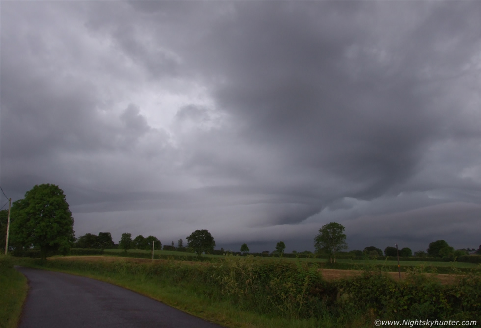 |
This is outside Ballyronan in the countryside looking to the SW at the approaching storm. That entire mass of cloud filling the 28mm wide angle frame is the approaching storm. The shelf filled the field, extended out of the frame on each side and stretched across the entire skyline. It was an absolute monster!. I was leaning the camera on the car roof here for this shot. All of these images are handheld and taken in a rush so excuse the poor photography. My adrenaline was pumping as I tried to take in this structure and the lightning. The shelf had a double stack profile with a horizontal bright line running along its entire length splitting the top and bottom tiers. Strange horizontal lines crossed the shelf and among these were more strange lenticular-type waves in the clouds. The area to the ROC was green and pink. If you look along that distant tree line you can just make out the precip curtain along the horizon. That area had rapid pink flashes of lightning illuminating the curtain which was beautiful.
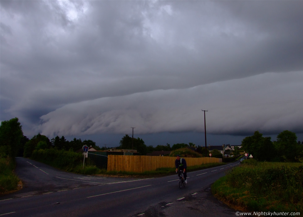 |
Driving on, I was in a state of panic because here was the best shelf cloud I have ever seen in my life and I couldn't get a decent image of it thanks to those obstructed N. Ireland roads. We passed the Marina, which was our intended target, and continued chasing this storm in the hope of finding a good location. We arrived at a road junction which provided the best view yet so I said ''stop, stop'', and that's exactly what we did at the stop sign. A quick check behind and no other cars were approaching so I got out of the car, leaned on the roof again, and began to take a number of hand held snaps. The sky was getting dark as the storm advanced, for some reason my camera didn't want to pick up the dark green colour of that precip band, it looks more like dark blue here, however green was the real colour. While taking images here I could see more pink lightning flashing in that rain behind the shelf. C-gs hit down behind those distant rooftops with distant rumbles and a few i-c bolts licking the rain higher up. It's a good job that cyclist is going in the other direction, however there was no chance of him beating this storm in a race, he probably had to get off his bike further up the road and take shelter. This shelf cloud extended across the entire sky as far as the eye could see.
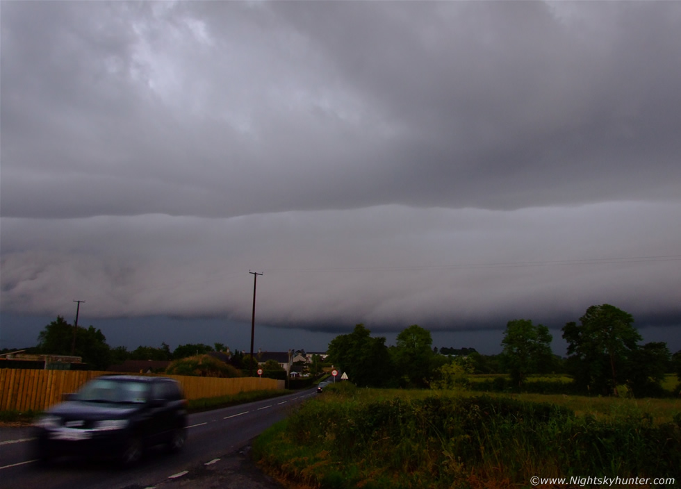 |
Same location but panning the camera a little more to the R showing the double stacked appearance. The lower tier at this stage looked like a solid feature like a concrete slab our window sill, that horizontal division was the marker that separated the two sections. The above tier was huge and was visible to a very high vertical extent. This thing was huge and frightening looking.
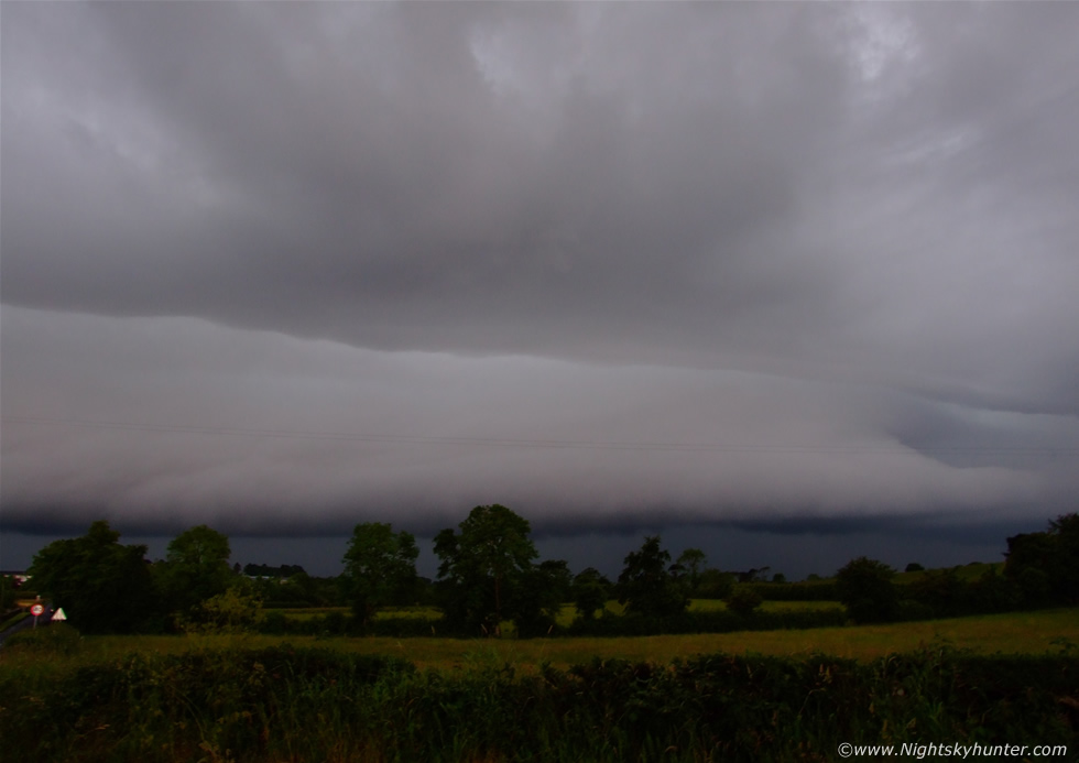 |
Panning the camera again further to the R, the road is just visible to the far L. More pink c-gs zapped something in those fields behind the tall trees.
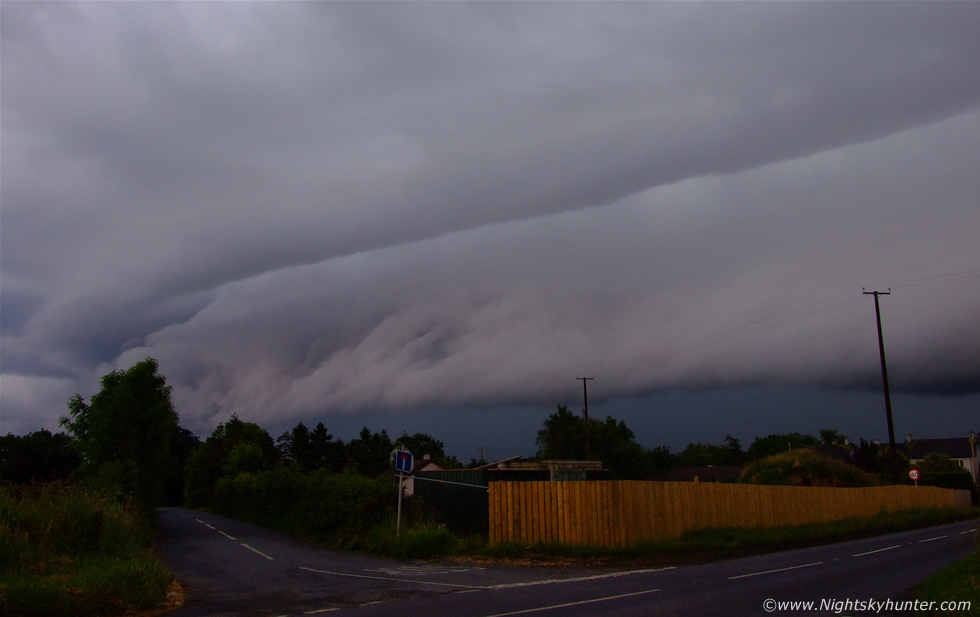 |
Back to the junction. I was hoping to catch one of those c-gs, or at least a pink flash under the shelf on a still image but I would have needed alot of luck for that. I still have yet to get my first daylight still image of lightning, I would need to have been clicking away non stop to have a chance however time was pressing on at this junction and I didn't want to exhaust the memory space on the card.
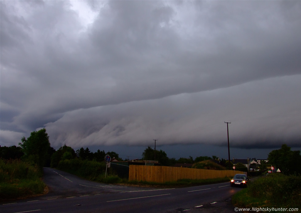 |
It was dark below the storm, evident by the headlights on this car. Another car was moving in behind us so we had to move on to avoid blocking the road.
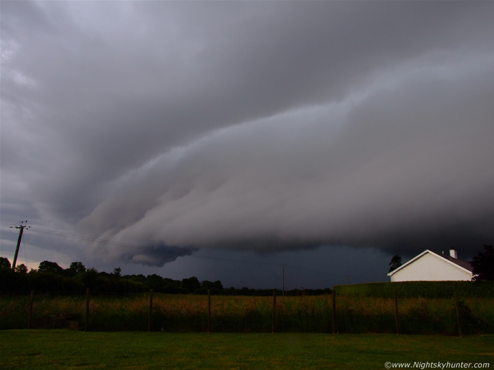 |
We kept driving until I spotted a small lay by on the road side so we pulled in there where we had a wonderful view of the shelf and storm. At least now I could get peace and a decent chance of recording this thrilling event. The storm looked mean with its incredible structure and dark green precip core as it passed over the colourful fields in front of us while casting a threatening dark shadow over the country. I got out from the car and set up the camera on the tripod and began to take images and video, there was still lightning and it was getting closer.
These are all 28mm wide angle and this is just one section of the entire shelf as it crossed the entire sky. I was exhilarated to see such awesome storm structure as this. I have seen some impressive shelf clouds before in N. Ireland but this here was in a league of its own and wouldn't have looked out of place over the US plains, which many people have since told me. In fact, Paul Knightly from TORRO said it looked similar to the shelf clouds which form on squall lines in the US. That nasty precip curtain was getting closer and already I was getting hit by raindrops from the outflow. I recall taking the image below because just after I pressed the shutter a nice c-g hit down, had I delayed taking the image by a sec or so I may have caught it.
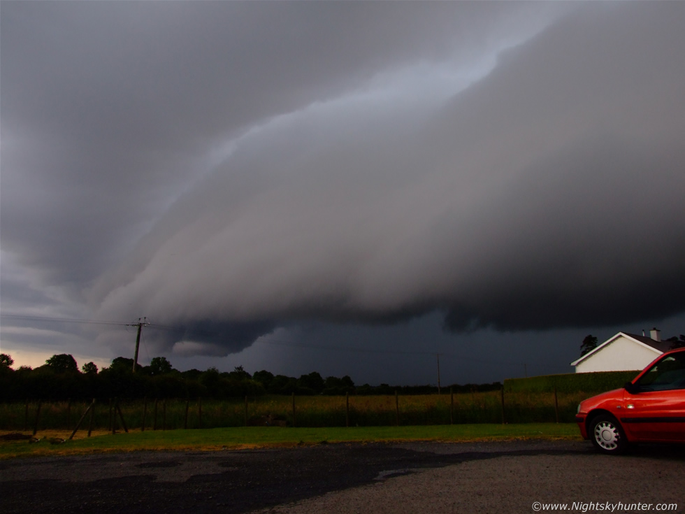 |
It was getting really dark now and the lightning bolts were beginning to make me worry. It was getting gusty with rain and I was still standing out in the open in a t-shirt. That's our car to the R. My Mum along with 'Drew', our Dog, stayed in the car. I think my Mum was a little scared at this point.
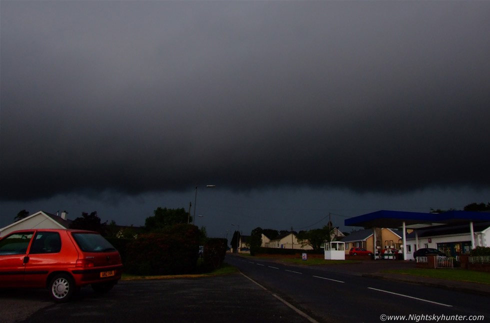 |
Turning the camera around to the R. Gust front/shelf almost on top of me. Some of the people in passing cars were sounding their horns and yelling out the window at me to cheer me on, which I thought was odd.
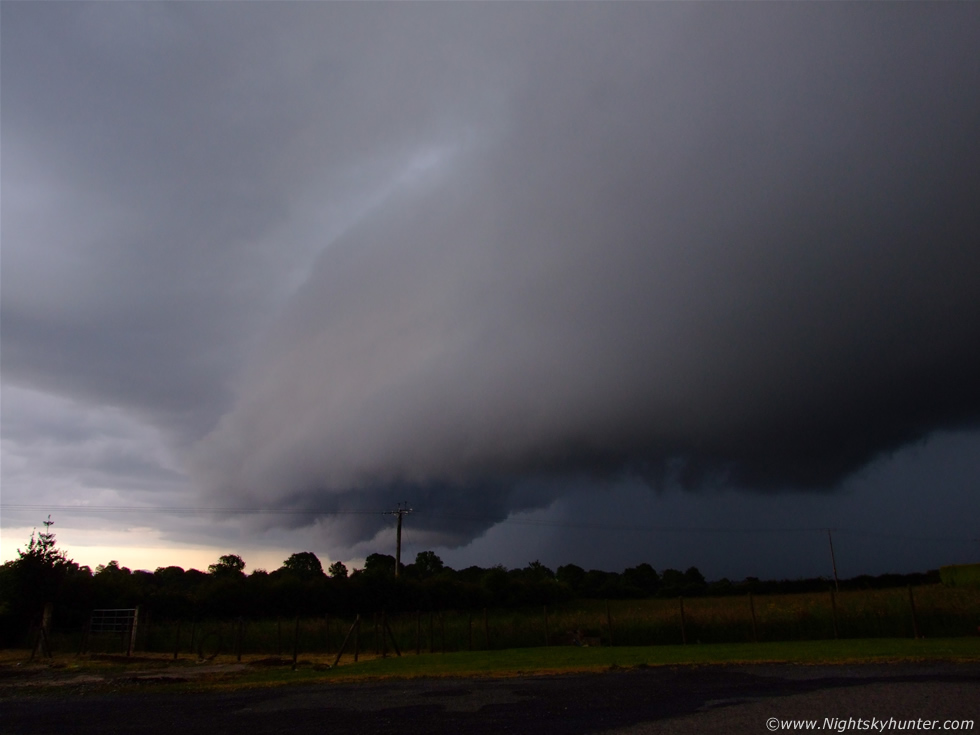 |
I was really chancing my arm at this stage, the lightning was just too close. There was turbulent motion under the leading edge of the shelf, it's not unusal to get funnel clouds or even tornadoes in this region so I was watching for one. A deadly pink c-g hit down and I could feel the static in the air so I decided that was enough. I ran back to the car to take shelter just as the heavy rain began, however before I did so I took one last video clip from outside and got rewarded with this nice catch...
 |
This is a still image from the video footage. What made this even more spectacular was the fact that this was three c-gs which hit down one after the other on the exact same spot...strike strike strike, in about one sec or so, it was incredible, when it did this it lit the rain up pink and green and illuminated the underside of the shelf and lay by quite brightly. You can see this bolt on the video clip at the bottom of the page, although it looks so much better on the high res version.
 |
Now back in the car, the time for structure shots was over. The outflow was hitting us good with very heavy rain. The only thing left to do was take video clips through the front windscreen at the precip core in the hope of catching some more bolts. The squeaky wipers were doing their best to clean the window but the rain was relentless. The shelf was now on the other side of the car (L) with nice whale's mouth underneath. It was at this time that we got to see some incredible lightning. Very often there would be a sudden pink flash, a result of three, and even four bolts flickering at the same time. Again, these were all pink with a mix of i-c and c-g. Here's another still showing one c-g caught during one of those bursts.
 |
Here's two more c-gs, although the wiper is in the way. You can see the pink colour of the sky very well here. After this three bright flashes lit the sky up at the zenith, and above us we could hear boom boom boom from the thunder which was fantastic. Drew does not like thunder and was laying behind the seats on the floor shaking with fear so we had to calm him down. We drove away again and went to the Marina, parked the car, and watched the lightning hitting the water on the Lough. Since the rain was torrential at this stage and flooding the roadsides we decided to head home. Eventually we managed to outrun the storm and the further N we drove the drier it got. Back in Maghera there was no sign that a great storm had occurred, the sky was quiet. Later the shelf made it here but it had become outflow dominant and just produced rain. When the rain cleared just before sunset the sky turned an amazing orange-red colour as if it was on a fire. To put the icing on the cake I could see a lovely reddened sunset rainbow in the E. The sky really showed off today and provided me with some of the most amazing storm scenes I have seen in years and memories which I shall never forget. The 2009 Spring and Summer sky has been action packed this year and long may it continue.
Here's a video clip which really does the shelf cloud justice. You can really appreciate how large this structure was when you get half way through the video. That's three thunderstorms I seen this day and the good news was that more were expected on the following day and that's where the next two image reports will start from. Thanks for reading.
Martin McKenna